

A Map That Tells a Story
If you’ve ever wondered who owned the land across Black Hawk County decades ago, the answer now hangs on a wall inside the Hudson Public Library.
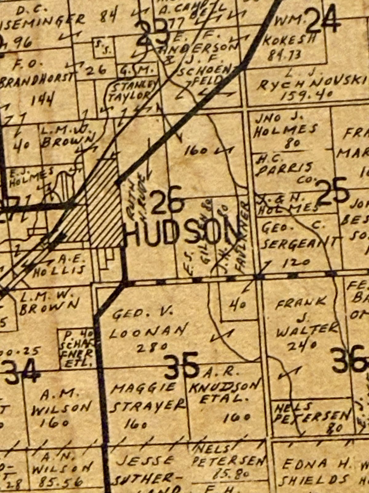
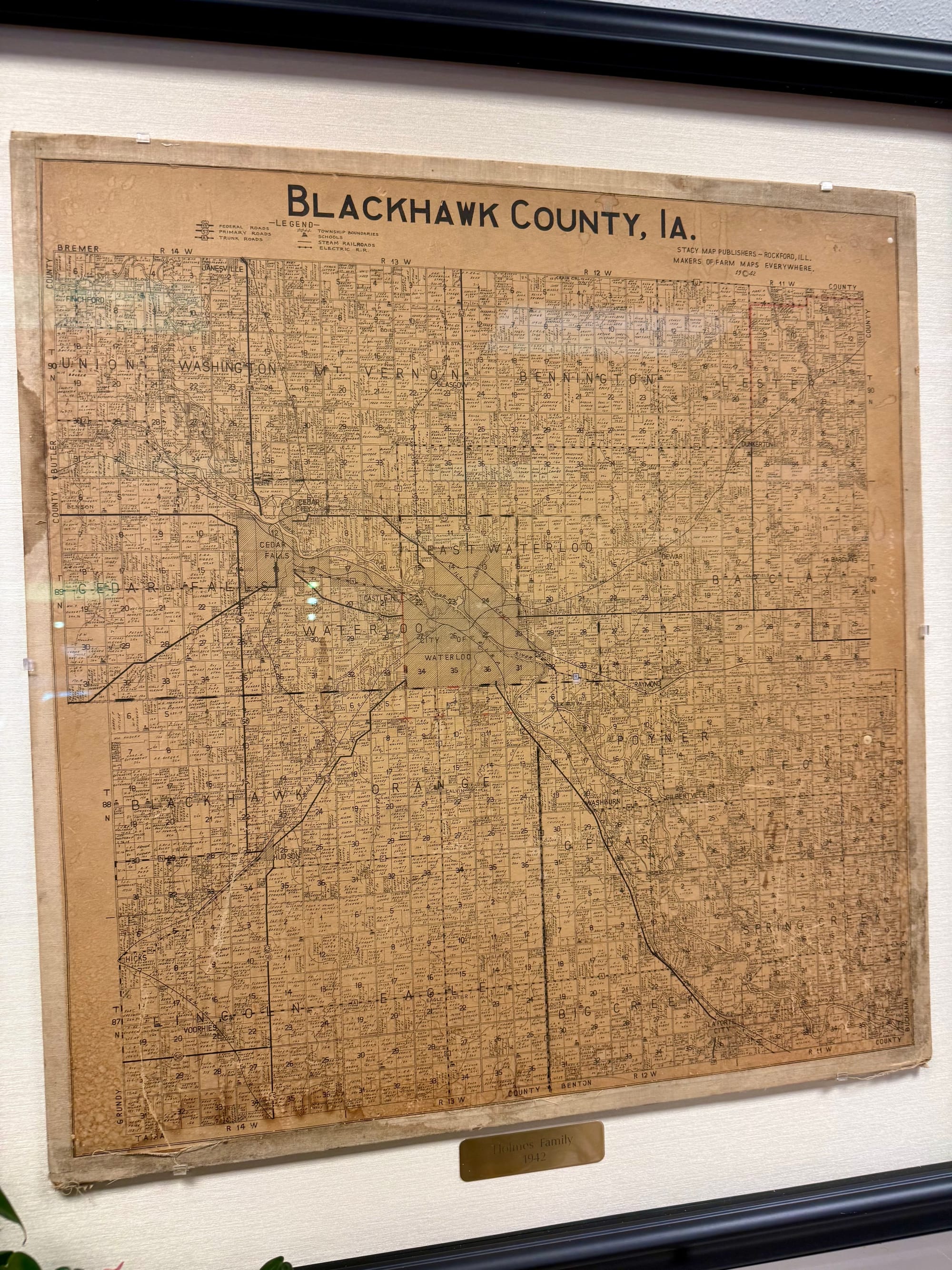
A large framed plat book map from 1942 offers a detailed snapshot of the county— down to individual landowners—preserved in time. The print was donated by Jim Holmes, who believes it once belonged to his grandfather, Dale Holmes, a Hudson farmer who likely used the map as a reference in his day-to-day work.
The piece carries more than geographic history—it reflects a family’s connection to the community. Holmes’ mother, Kathleen, served as the Hudson library director for decades, making the donation a meaningful full-circle moment.
A closer look at the map reveals Hudson as it appeared in 1942, surrounded by the names of farmers and families who shaped the area. What was once a practical tool is now a window into the past—one that invites today’s residents to pause, look closer, and recognize the roots beneath their feet.


Comments ()